Third Slide in North Westside in Two Weeks
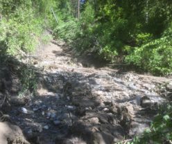
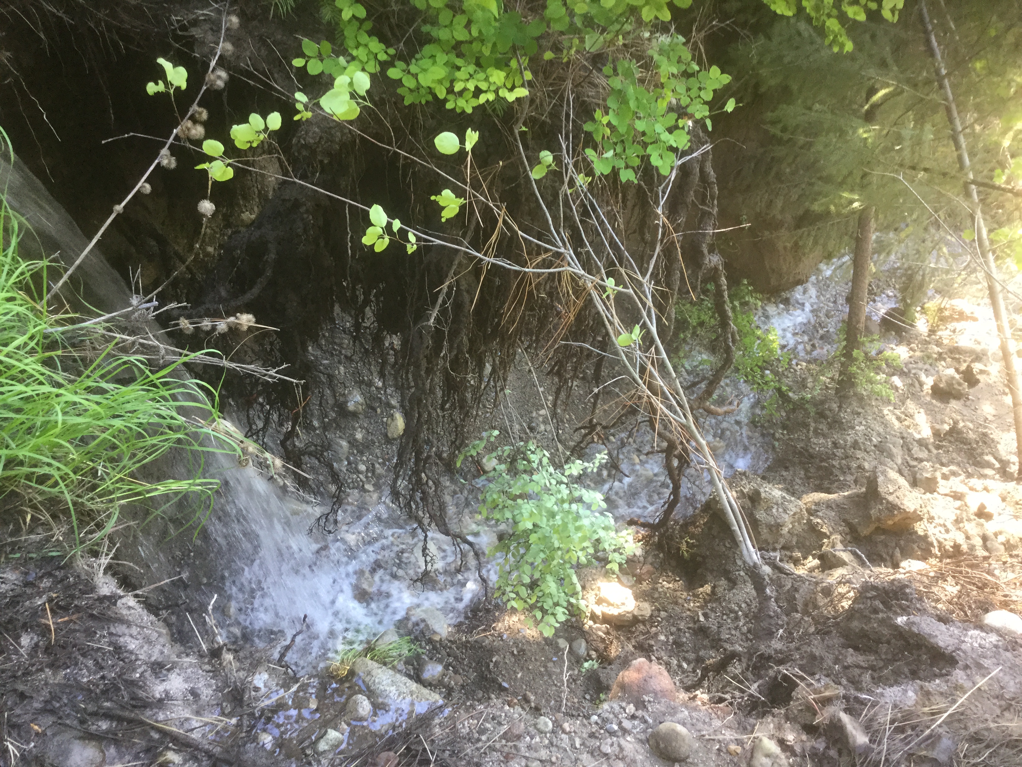
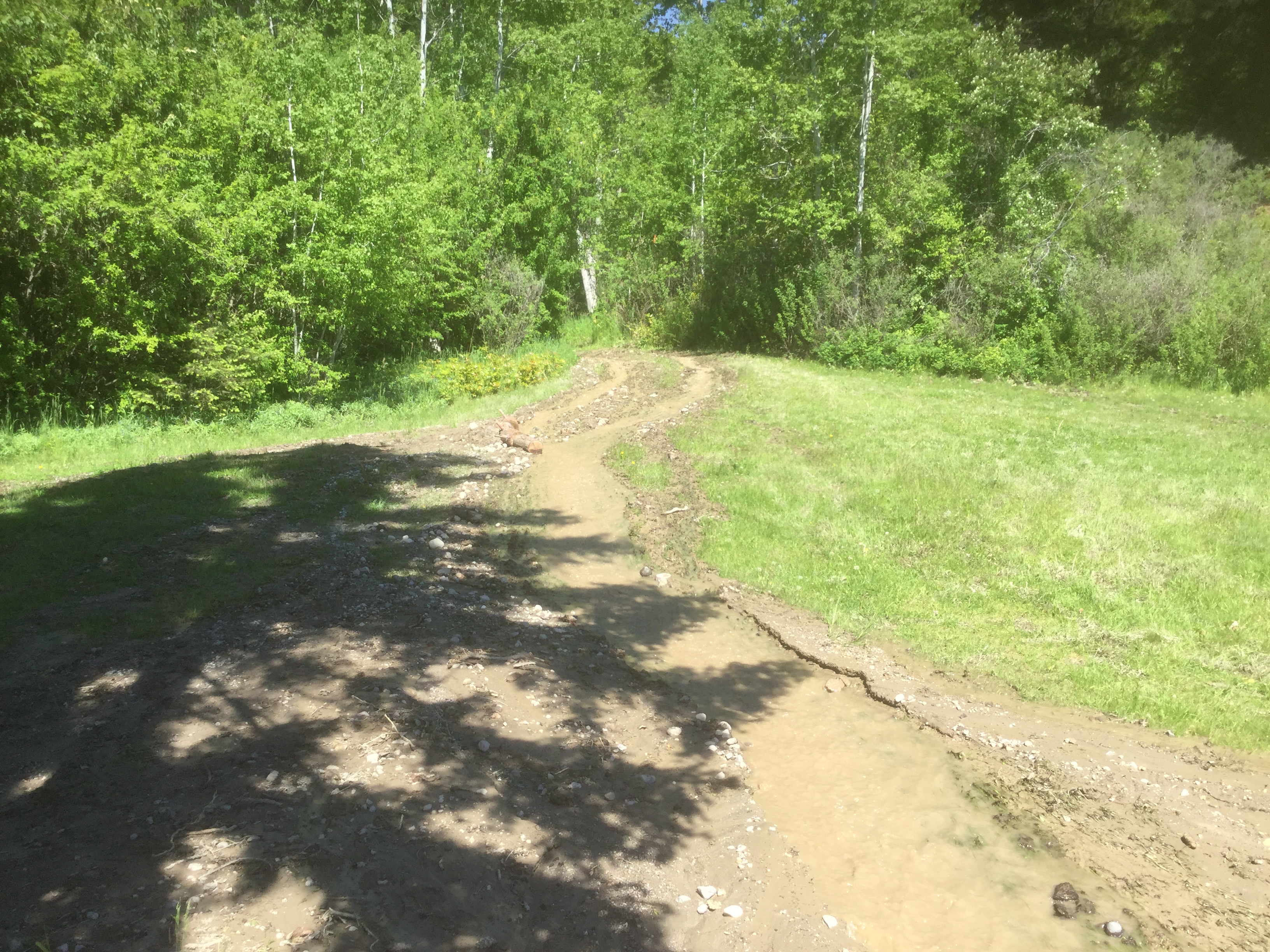
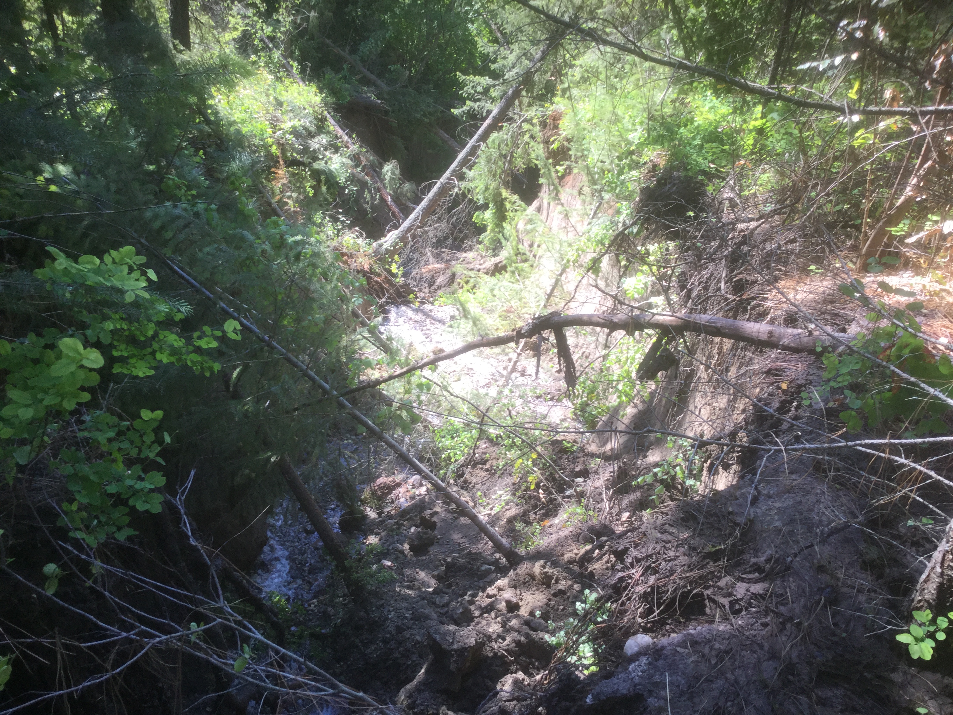
Pictures and videos of the Marchbank slide. The first picture is looking down the slide path. The first video is a walk down the slide the second video is a walk up the slide path.
Fortunately no one was injured, structural damage was to a cistern and septic system with a lot of mud and water throughout the three properties affected. A tactical evacuation was implemented with a geo tech due today to assess the stability in the area and access road.
All this activity has been keeping the North Westside Fire a very active group.
Here is the latest release from RDCO.
Landslide Forces North Westside Evacuation; Lake Level Update – News Release #65
Landslide Forces North Westside Evacuation; Lake Level Update
Kelowna, B.C. – A tactical evacuation has been conducted, as a safety precaution, for two homes, due to a small landslide on Marchbank Road, off Westside Road, north of Killiney Beach.
No one was injured. Geotechnical evaluations are being conducted Sunday. One home was not occupied and a family of three living in the second home will be referred to Emergency Support Services in Vernon for assistance, if needed.
Emergency Support Services is available for urgent matters by calling 250-469-8490; the reception centre will reopen Tuesday, May 23 from 11 a.m. to 2 p.m. unless otherwise needed. The Emergency Operations Centre remains open; and BC Forestry and various municipal crews also continue to provide on the ground support throughout the long weekend.
Information on identifying landslide risks and protecting yourself and your home can be found on the PreparedBC website at: http://www2.gov.bc.ca/gov/content/safety/emergency-preparedness-response-recovery/preparedbc/know-the-risks/landslides.
Okanagan Lake Levels and Flood Preparation
Okanagan Lake rose 3.7 centimetres Saturday, bringing the level to 342.83 metres – 4cm off 1990s flood level and 17cm away from this year’s projected peak of 343m. High temperatures are now causing the upper snowpack to melt. The lake will rise for approximately three more weeks.
Lakefront residents are urged to protect their properties from flooding if they have not already done so. To check whether a property needs flood protection, go to the Flood FAQs (frequently asked questions) section of www.cordemergency.ca/beprepared, which contains directions on how to measure for flood levels and build barriers to the appropriate height for the projected lake level and to account for wave action.
Emergency Operations Centre officials conducted a detailed shoreline survey and surveillance flights to determine where flooding will likely occur up to 343.6m – the projected Okanagan Lake flood level (343m), plus a buffer for wave action. Officials observed that many at-risk lakefront properties lack adequate foreshore protection to this level.
Flooding has already started to occur in low-lying areas, so the sooner flood measures are in place, the better. Simple steps like placing sandbags and removing valuables from below ground basements and crawlspaces will help protect at-risk properties.
Sandbagging stations are stocked and replenished daily at several locations throughout the Central Okanagan. Visit www.cordemergency.ca/map to find the location closest to you.
Please, Don’t Boat!
Boating is not recommended because wakes can cause significant impacts on vulnerable properties. Boaters choosing to access Okanagan Lake are urged to drive slowly, stay away from the shore and avoid several areas at risk due to high waters and wave action.
Boat wakes can have significant impact on vulnerable properties. Boaters are reminded that they can be fined for operating a power-boat over 10 km/h within 30 metres of shore. Boaters who choose to disregard safety notifications may also be fined.
Flooding has deposited significant debris in Okanagan Lake, including large trees, branches, and even submerged docks, making navigation on the lake hazardous.
Flood Protection Work Continues
Municipal and public safety crews continue to install flood protection works including sandbag walls, bladder dams and gabion barriers. The public is asked to leave these installations alone for their own safety and to ensure the continued protection of community infrastructure and property.
Debris washed up on beaches should be left for the time being, as logs and other wood material can help to limit erosion caused by wave action. When the flood risk has passed, officials will provide details about how beach debris will be removed.
Find information on flood preparation, including sand and sandbag locations, how to effectively build sandbag walls and secure docks at www.cordemergency.ca/beprepared/flood-faq. For municipal-specific information, including the status of boat launches, waterfront park and beach closures, visit individual city or district websites:
Regional District of Central Okanagan
Here are some photos of the slide path and the mud and debris around the structures.